Surveys
- Home > Services > Surveys
- Our Services
Accurate Data . Reliable Insights. Stronger Foundations.
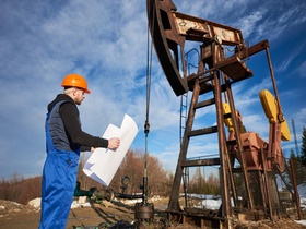
Our expertise spans land, marine, and structural environments, enabling clients to make informed decisions based on accurate, verified, and reliable data.
From topographical mapping to geotechnical investigations and bathymetric surveys, our team uses modern technology, advanced equipment, and industry-proven methodologies to support projects across Tanzania and beyond.

Our Surveys Approach
01
01.Project Understanding & Scope Definition
02
02. Field Data Collection
03
03. Data Processing & Analysis
04
04. Reporting & Deliverables
Our Specializations
High-Accuracy Field Measurements
Precise data collection for design, construction, and monitoring.
Digital Mapping & GIS Services
Converting survey data into detailed, geo-referenced digital maps.
Engineering Surveys for Construction
Reliable layout, alignment, and level setting for construction activities.
Terrain & Landform Analysis
Elevation models that support design, planning, and flood assessment.
Boundary & Property Surveys
Accurate demarcation and verification for land ownership and subdivision.
Infrastructure Condition Assessments
Evaluating existing structures to support rehabilitation and maintenance planning.
Our Surveys Services
Geotechnical Investigation (Onshore & Offshore)
We conduct comprehensive geotechnical investigations to evaluate soil, rock, and seabed conditions for safe and reliable project design. Our services include drilling, sampling, in-situ testing (SPT, CPT, Vane Shear), geophysical surveys, and laboratory analysis. Whether onshore or offshore, we deliver accurate geotechnical data essential for foundations, marine structures, pipelines, tank farms, and major infrastructure developments.
Bathymetric Surveys
Our bathymetric surveys provide detailed mapping of underwater terrain to support coastal engineering, dredging, navigation channel design, and marine construction planning. Using advanced echo-sounders, GPS, and hydrographic software, we generate precise seabed profiles, depth measurements, and volumetric assessments, ensuring safe marine operations and well-informed engineering decisions.
Topographical Surveys
Cadastral Surveys
Condition Surveys for Rehabilitation Works
- FAQ's
Quick and clear answers to your key questions
01What types of projects require survey services?
02Do you provide digital deliverables like CAD or GIS files?
03How long does a typical survey take?
04Do you assist with regulatory or land registration processes?
05Can surveys be conducted in remote or difficult terrain?
Absolutely, our team is equipped to handle challenging environments both onshore and offshore.
06Do you use modern equipment and surveying technology?